The motorcycle communication systems field just got a significant upgrade with the release of the Fodsports FX7. This state-of-the-art Bluetooth mesh intercom is packed with many advanced features and techs. It will revolutionize the way riders communicate and enjoy their rides. Whether you're a solo rider or part of a group, the FX7 offers unparalleled […]

Blue Ridge Parkway Fall Motorcycle Trip: Route, Foliage, Stops and Riding Tips
September 21, 2026
Few motorcycle roads combine mountain scenery, flowing curves, historic landmarks, and autumn color as naturally as the Blue Ridge Parkway. Stretching 469 miles from Rockfish Gap, Virginia, to Cherokee, North Carolina, the Parkway crosses changing elevations and several Appalachian mountain ranges, creating a long seasonal window for fall foliage.
The key to a great Blue Ridge Parkway motorcycle trip is not trying to ride all 469 miles in one day. Instead, choose a section based on foliage timing, weather, road conditions, and the stops you actually want to enjoy. In autumn, higher elevations usually change color first, followed by the lower valleys, so moving through different elevations can dramatically increase your chances of finding peak foliage.
From a rider's perspective, the Parkway rewards smooth riding rather than speed. The road's sweeping curves, elevation changes, overlooks, and constantly changing scenery make it more enjoyable when you leave enough time to stop, take photos, and simply enjoy the ride.
Table of Contents
🛣️ Blue Ridge Parkway Motorcycle Route at a Glance
The Parkway is 469 miles long and is marked by mileposts from MP 0 in Virginia to MP 469 near Cherokee. Its normal speed limit is 45 mph, with several sections reduced to 35 or 25 mph for safety. Motorcycles are permitted, while commercial traffic is not.
The highest elevation on the Parkway road is about 6,053 feet at Richland Balsam near MP 431. This large elevation range is one reason fall color develops at different times along the route.
The Parkway also has more than 200 formal scenic overlooks, meaning riders do not need to stop at every famous attraction to enjoy spectacular scenery. NPS recommends allowing extra time because October weekends can bring heavy traffic and delays.
🍁 When Is the Best Time for Blue Ridge Parkway Fall Foliage?
Higher Elevations Change First
There is no single perfect fall foliage date for the entire Parkway. According to the Blue Ridge Parkway Association, the highest elevations can begin changing in late September or early October, while mid-elevations generally show strong color around mid-October. Lower elevations change later.
This creates an important advantage for motorcycle travelers: you can chase the color by changing elevation.
For example, if the trees around a high-elevation overlook are already past peak, riding toward a lower elevation may put you back into the best color. Visit North Carolina similarly notes that fall color moves downhill through the mountains rather than appearing everywhere at the same time.
October Is the Main Fall Riding Month
October is generally the busiest foliage month, so weekdays and early mornings can provide a more relaxed experience. If your schedule is flexible, avoid planning your entire trip around one exact “peak color” prediction. Weather, rainfall, temperature, and elevation all influence the timing and intensity of the display.
🌄 Best Fall Stops Along the Blue Ridge Parkway
Mabry Mill
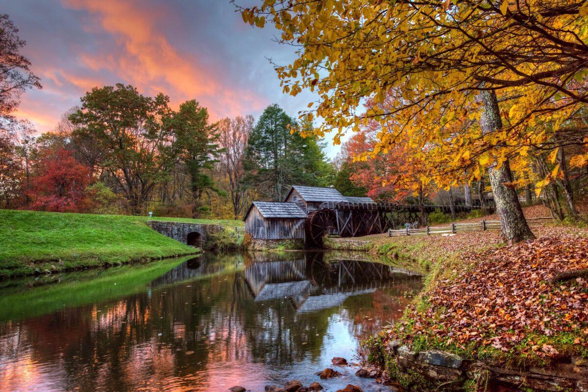
At approximately MP 176, Mabry Mill is one of the Parkway's most recognizable historic sites. The restored mill, pond, surrounding forest, and autumn foliage create one of the classic photo opportunities on the Virginia section.
For motorcycle travelers, it is also a useful place to slow down, stretch your legs, and take a break from the continuous mountain curves.
Mabry Mill
Peaks of Otter
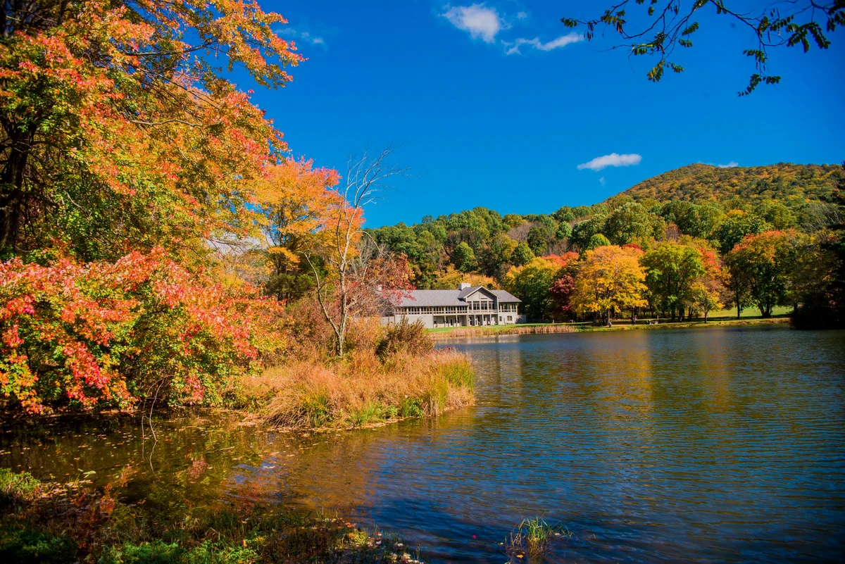
Around MP 86, Peaks of Otter combines Abbott Lake, mountain scenery, hiking opportunities, and nearby services. It works particularly well as a longer stop during a Virginia riding day.
Peaks of Otter
Moses H. Cone Memorial Park
Near MP 294, the Moses H. Cone Memorial Park provides a completely different autumn experience, combining mountain scenery with historic architecture, meadows, and carriage trails. It is an excellent place to take a break from the motorcycle and walk for a while.
Linn Cove Viaduct
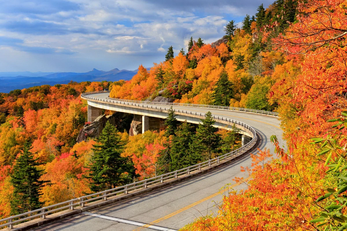
The Linn Cove Viaduct near MP 304.4 is one of the defining engineering features of the Blue Ridge Parkway. The road curves around Grandfather Mountain while the surrounding forest provides an exceptional autumn backdrop.
Linn Cove Viaduct
For riders, this section is about more than taking a photograph. The combination of elevation, curves, mountain views, and changing weather makes it one of the most memorable sections of a Blue Ridge Parkway motorcycle ride.
Craggy Gardens and Waterrock Knob
Further south, Craggy Gardens and Waterrock Knob offer high-elevation scenery and expansive mountain views. Waterrock Knob is particularly useful for sunrise or sunset photography, while Craggy Gardens is known for its high-elevation landscape and seasonal color.
🏍️ Blue Ridge Parkway Motorcycle Riding Tips
Slow Down Before the Curve
The Parkway was designed as a scenic road, not a high-speed motorcycle route. NPS specifically warns riders about decreasing-radius curves, where the corner becomes tighter as you progress through it. This is one of the situations where entering a corner too quickly can create problems.
Maintain a controlled speed, look through the corner, and leave yourself room to react to oncoming traffic.
Watch for Leaves, Gravel and Wildlife
Fall creates additional surface hazards. Wet leaves, fallen branches, gravel, rocks, and rain can reduce traction, especially on shaded sections.
Wildlife is another consideration. Deer and other animals can suddenly cross the road, while scenic overlooks may have pedestrians entering or leaving parking areas. NPS advises riders to stay attentive to these built-in distractions.
Give Group Rides More Space
If you are riding with friends, NPS recommends single-file group riding on the Parkway because of its curves and limited sight distances. Keeping more space between motorcycles also gives each rider additional room to react.
A Motorcycle Intercom or Helmet Communication system can also make group coordination easier, particularly when riders need to communicate about upcoming stops, traffic, weather, or road conditions. For longer group rides, a Bluetooth Intercom can be a practical part of the touring setup.
⛽ Fuel, Weather and 2026 Road Conditions
Plan Fuel Before Entering the Parkway
Do not treat the Parkway like a normal highway with frequent fuel stations. Gasoline and other services are generally available off the Parkway, so riders should plan fuel stops around their motorcycle's realistic range rather than waiting until the tank is nearly empty.
For a multi-day Blue Ridge Parkway motorcycle tour, identify fuel, food and accommodation points before leaving each morning.
Check Road Conditions on the Day of Your Ride
This is particularly important in 2026.
Hurricane Helene caused extensive damage across western North Carolina. The NPS reported at least 57 landslides affecting nearly 200 miles of Parkway in North Carolina, and recovery work continues in several areas. Some projects have target completion dates extending into 2026.
Therefore, a route that appears perfect on an older travel guide may not be fully accessible today. The NPS road-status page should be checked immediately before departure because closures can change with construction, weather, or emergency conditions.
🎒 What to Pack for an Autumn Motorcycle Ride
Fall mountain weather can change quickly, particularly at elevations above 4,000 or 5,000 feet. A layered riding jacket, waterproof outer layer, warm gloves, and comfortable base layer are useful even when the valley forecast looks mild.
Navigation is also important because the Parkway has long stretches between developed areas. Download offline maps before leaving and keep your phone charged.
For group travelers, a Motorcycle Intercom can help coordinate fuel stops and route changes without repeatedly stopping. A compact tire repair kit, basic tools, first-aid supplies, water, and a power bank are also worth carrying.
The goal is simple: prepare for a normal fall day while being ready for a colder, wetter mountain section.
🗺️ A Practical One-Day Fall Riding Plan
For a first trip, avoid trying to cover the entire Parkway.
A practical North Carolina option is to choose a section around Blowing Rock, Moses Cone, Linn Cove Viaduct, and nearby High Country overlooks, then build the day around several longer stops rather than simply collecting miles.
Start early, especially on a weekend. Ride the scenic section during the morning, stop for breakfast or coffee near an access town, spend time around Linn Cove Viaduct and Moses Cone, and leave enough daylight for the return journey.
Another approach is to base yourself around Asheville and explore the southern Parkway section toward Craggy Gardens, Mount Pisgah, or Waterrock Knob, depending on current road access.
This flexible approach is usually more enjoyable than trying to complete 200 or 300 miles in a single autumn day.
📊 Blue Ridge Parkway Facts Riders Should Know
The Parkway's scale explains why it is such a significant motorcycle destination:
- 469 miles from Virginia to Cherokee, North Carolina.
- 45 mph standard speed limit, with lower limits in specific areas.
- More than 200 scenic overlooks along the route.
- 6,053 feet — highest elevation of the Parkway road at Richland Balsam.
- 15.7 million recreation visits were recorded by NPS in 2022, demonstrating the Parkway's enormous popularity.
- NPS says rangers investigate an average of about 200 accidents per year, with roughly half resulting in serious injury; its motorcycle-specific page reports up to 250 motorcycle crashes annually. These figures reinforce why controlled riding and attention matter more than chasing speed.
A Blue Ridge Parkway fall motorcycle trip is less about covering distance and more about experiencing the changing landscape. The 469-mile route gives riders an unusual advantage: when foliage fades at one elevation, another section may just be reaching its peak.
For the best experience, choose your route according to elevation and current road conditions, start early, keep fuel in mind, ride smoothly through the curves, and leave plenty of time for overlooks.
Most importantly, remember that the Parkway is a scenic road first and a motorcycle road second. Slow down, watch the road, and let the autumn scenery come to you.
❓ Frequently Asked Questions
What is the best month to ride the Blue Ridge Parkway in fall?
October is generally the main fall foliage month, but the exact timing depends heavily on elevation and weather. Higher elevations can peak in late September or early October, while lower areas may show strong color later in October.
How long does it take to ride the Blue Ridge Parkway?
The entire 469-mile route can take several days if you want to enjoy overlooks, hikes, meals, photography, and nearby towns. For most riders, dividing the route into manageable daily sections is more practical than attempting the entire Parkway in one day.
Is the Blue Ridge Parkway good for beginner motorcycle riders?
The Parkway can be approachable because of its moderate speed limits and flowing road design, but beginners still need to respect decreasing-radius curves, narrow shoulders, elevation changes, wildlife, and changing weather. NPS specifically recommends extra caution for motorcyclists.
Are there gas stations directly on the Blue Ridge Parkway?
Riders should not rely on finding regular fuel services directly along the Parkway. Plan fuel stops near access roads and towns, and check your motorcycle's range before starting a long section.
Is the Blue Ridge Parkway open everywhere in fall 2026?
Not necessarily. Hurricane Helene recovery, construction, weather, and other events can affect access. Check the official NPS Road Status and Closures page immediately before your ride rather than relying on an older itinerary.
📚 Authoritative Sources
- National Park Service — Blue Ridge Parkway: https://www.nps.gov/blri/index.htm
- National Park Service — Road Status and Closures: https://www.nps.gov/blri/planyourvisit/roadclosures.htm
- National Park Service — Motorcycle Safety / Rule the Ridge: https://www.nps.gov/blri/planyourvisit/motorcycle-safety.htm
- Blue Ridge Parkway Association — Fall Color Guide: https://www.blueridgeparkway.org/plan-your-parkway-trip/stories-guides/fall-color-on-the-parkway
- Visit North Carolina — Blue Ridge Parkway: https://www.visitnc.com/blue-ridge-parkway

Rodney L is a technical writer and product consultant with over a decade of experience in the motor industry. Rodney is a fan of performance machines that run fast and loud and an expert in all things custom. His numerous articles and write-ups are available at our knowledge base. Whether it’s something wrong with your motorcycle or you are building a custom bike, you can trust Rodney’s experience.
You maybe like to read:
Fodsports Brand Month: Unbeatable Deals and Top-Notch Service
Discover Fodsports Brand Month July and August mark a special occasion for motorcycle enthusiasts and tech lovers alike. Welcome to Fodsports Brand Month! This event is dedicated to celebrating everything that makes Fodsports a leading name in the motorcycle communication industry. Get ready for a fantastic promotions, exceptional service from Fodsports. Let's insights into Fodsports' […]
Blue Ridge Parkway Fall Motorcycle Trip: Route, Foliage, Stops and Riding Tips
Few motorcycle roads combine mountain scenery, flowing curves, historic landmarks, and autumn color as naturally as the Blue Ridge Parkway. Stretching 469 miles from Rockfish Gap, Virginia, to Cherokee, North Carolina, the Parkway crosses changing elevations and several Appalachian mountain ranges, creating a long seasonal window for fall foliage. The key to a great Blue […]
Adirondack Mountains in Fall: Highlights and Motorcycle Riding Guide
Few places in New York offer a better combination of mountain roads, lakes, forests, and fall color than the Adirondack Mountains. For motorcycle riders, autumn brings an extra layer of appeal: winding roads surrounded by red, orange, and golden foliage. The Adirondack Park covers about 6 million acres, with more than 3,000 lakes and roughly […]
Vermont Route 100 in Fall: Highlights and Motorcycle Riding Guide
Vermont Route 100 is one of New England’s most rewarding roads for a fall motorcycle ride. Stretching roughly 216 miles through the Green Mountains, the route connects mountain scenery, colorful forests, farms, covered bridges, and small Vermont towns. For motorcyclists, however, a great fall ride requires more than choosing a scenic road. Autumn brings colder […]
Kancamagus Highway Motorcycle Trip: Autumn Foliage, Route and Safety Tips
Few American motorcycle roads combine mountain scenery, flowing curves, forest color, and accessible riding as effectively as New Hampshire’s Kancamagus Highway. In autumn, the route changes from a beautiful mountain road into a moving landscape of red maple, golden birch, dark evergreen forest, rocky overlooks, and rushing river valleys. Known locally as “The Kanc,” this […]