The motorcycle communication systems field just got a significant upgrade with the release of the Fodsports FX7. This state-of-the-art Bluetooth mesh intercom is packed with many advanced features and techs. It will revolutionize the way riders communicate and enjoy their rides. Whether you're a solo rider or part of a group, the FX7 offers unparalleled […]

Cherohala Skyway Tennessee and North Carolina: Fall Motorcycle Riding Guide
September 29, 2026
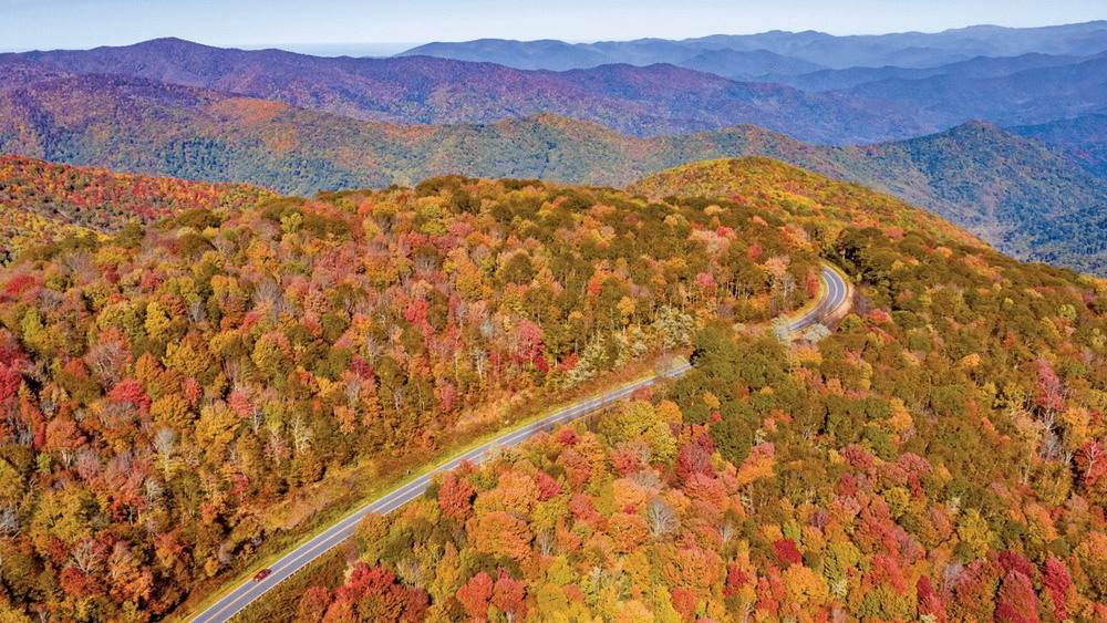
Few motorcycle roads in the Southeast combine elevation, open mountain views, and flowing curves quite like the Cherohala Skyway. Stretching about 43 miles between Tellico Plains, Tennessee, and Robbinsville, North Carolina, the National Scenic Byway climbs from lower valleys to elevations above 5,000 feet before crossing the Appalachian high country.
In fall, the ride becomes even more distinctive. Forests change color at different elevations, mountain overlooks open toward distant ridges, and cooler temperatures add another dimension to the journey. For riders planning a Cherohala Skyway fall motorcycle ride, the key is to slow down enough to enjoy the route while planning carefully for elevation, weather, fuel, and changing road conditions.
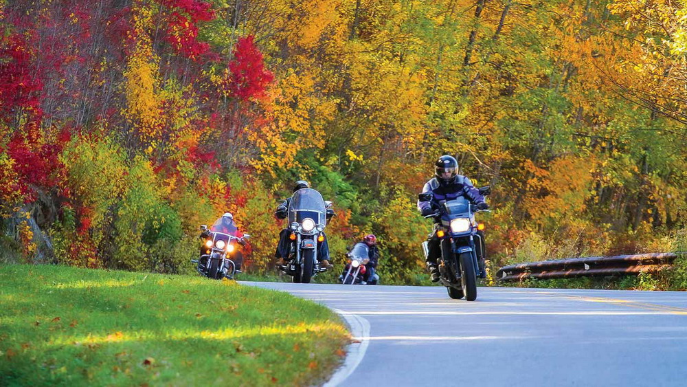
Cherohala Skyway fall motorcycle ride
Table of Contents
🍂 Why Ride the Cherohala Skyway in Fall?
The Cherohala Skyway was completed in 1996 and passes through the Cherokee and Nantahala National Forests. America's Byways lists the route at 42.95 miles, with about two hours needed to drive it without extended stops.
Its elevation is one of the main reasons fall is so impressive here. Visit North Carolina notes that the route rises from about 2,660 feet to 5,390 feet on the North Carolina side, creating noticeably different mountain environments during the ride.
Instead of one continuous wall of autumn color, riders can watch the landscape change as the road climbs. Lower forests may still have green leaves while higher sections are already showing strong fall color.
The result is a ride that feels more like a journey through several Appalachian landscapes than a single scenic road.
📅 When Is the Best Time for Cherohala Skyway Fall Foliage?
There is no single peak-foliage date for the entire Skyway because elevation has such a strong effect on the timing.
Early to Mid-October
Higher elevations can begin showing fall color earlier. This period can also offer cooler riding temperatures without the foliage season being finished at lower elevations.
Mid to Late October
October is generally the key month for a Cherohala Skyway fall ride. Tennessee's tourism office highlights October as an excellent time to experience fall scenery along the route.
However, riders should check current foliage reports before choosing a date. Temperature and weather patterns can shift peak color from year to year.
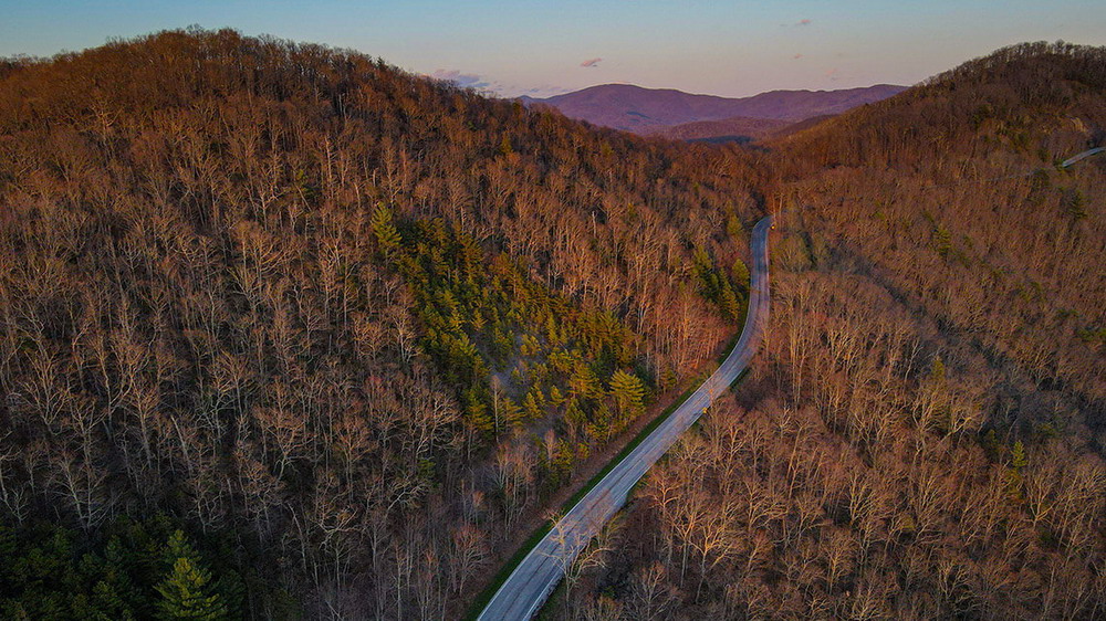
Cherohala Skyway high elevation overlook
🏍️ The Best Way to Ride the Cherohala Skyway
The Cherohala Skyway differs from roads known primarily for extremely tight corners.
North Carolina's official tourism guide describes the Skyway as a 43-mile route with long, sweeping curves, while the Forest Service identifies it as a destination for motorcycle enthusiasts.
That makes smooth riding particularly important.
Start in Tellico Plains
Tellico Plains is the natural western starting point in Tennessee. The Skyway follows TN-165 from the area before climbing into the Cherokee National Forest. Recreation.gov recommends Tellico Plains as the Tennessee access point.
It is also the sensible place to handle fuel, food, and last-minute preparation before entering the more remote mountain sections.
Start in Robbinsville
From North Carolina, the route begins near Robbinsville and follows NC-143 toward the Tennessee border. Recreation.gov identifies Santeetlah Gap as the beginning of the North Carolina section.
Either direction works well. Your choice can depend on where you're staying and which additional roads you want to ride afterward.
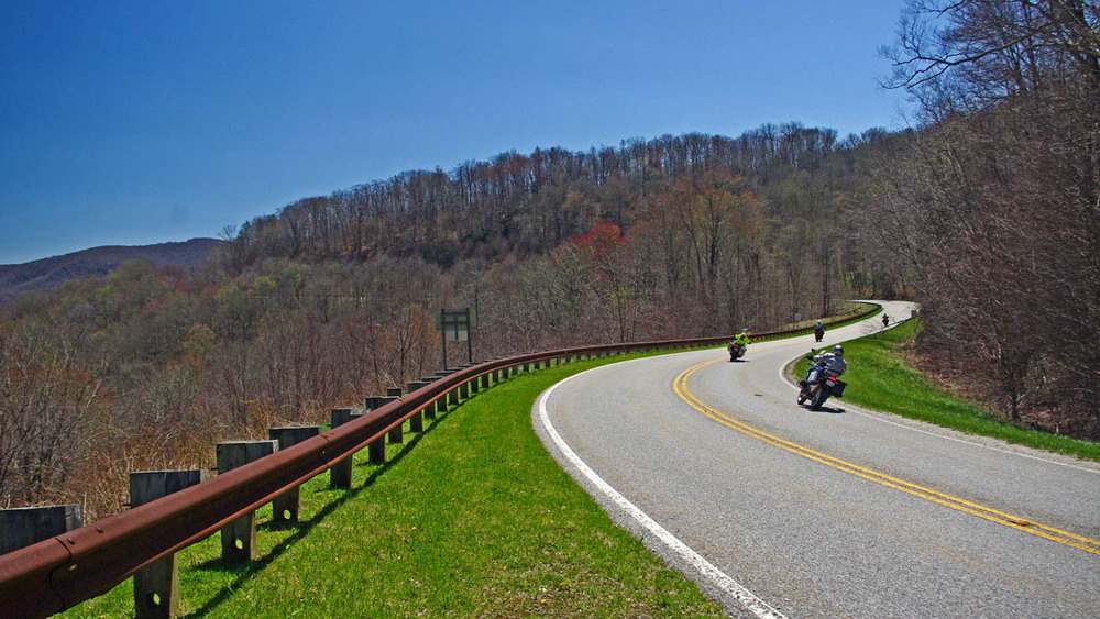
cherohala skyway motorcycle route
🌄 Scenic Stops Worth the Ride
The Skyway is designed around the journey, but several areas deserve extra time.
Turkey Creek Overlook
Located near the Tennessee side, Turkey Creek Overlook provides an easy opportunity to stop and take in the surrounding mountains. Tennessee tourism lists it among the Skyway's scenic overlooks.
High-Elevation Overlooks
As the road climbs, the forest opens into broader Appalachian views. These higher sections are especially valuable in fall because the changing foliage spreads across multiple ridgelines.
There are numerous pull-offs along the route, so riders do not need to stop in unsafe roadside locations simply to take a photograph.
Joyce Kilmer Memorial Forest
The Joyce Kilmer Memorial Forest is a worthwhile side trip for riders who want to stretch their legs. Recreation.gov lists it among the notable attractions near the Skyway.
Bald River Falls
On the Tennessee side, Bald River Falls provides another popular nearby stop. It pairs naturally with the Skyway when riders want to add a waterfall and forest setting to their trip.
🍁 What Makes the Fall Ride Different?
The most interesting part of a Cherohala Skyway motorcycle ride may be the relationship between elevation and scenery.
The route climbs from the lower Tennessee landscape toward mountain elevations around 5,000 feet. As the temperature and vegetation change, so does the appearance of the forest.
This creates excellent conditions for photography, but it also means riders should expect different weather during one trip.
A clear morning in Tellico Plains can become much cooler, windier, or foggier near the ridges.
That is one reason the Skyway should be treated as a mountain route rather than simply a scenic highway.
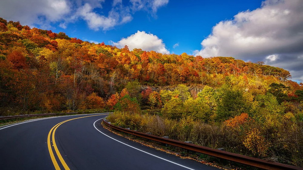
Cherohala Skyway autumn mountains
⚠️ Riding Considerations for the Skyway
The road has long sweeping curves and relatively open sections, but that does not mean riders should treat it as a high-speed route.
A Federal Highway Administration motorcycle safety audit identified specific changes in road character along NC-143 and noted issues such as motorcyclists crossing the centerline in the study area. The report also highlights the importance of understanding how the road changes beyond the designated Skyway section.
For riders, the practical lesson is straightforward: maintain a comfortable speed, stay within your lane, and leave enough sight distance for unexpected traffic or road debris.
Fall can also bring wet leaves, gravel, fog, and wildlife onto mountain roads. North Carolina tourism specifically advises riders to be prepared for changing mountain weather and conditions.
📡 Group Riding and Communication
A long mountain route can naturally spread a group apart, especially when riders stop at different overlooks.
A Helmet Communication system can help riders share information about regrouping points, traffic, or planned stops without repeatedly pulling over.
A Bluetooth Intercom is useful for short rider-to-rider communication, while a Motorcycle Intercom can help larger groups coordinate more efficiently.
On a scenic road like Cherohala, communication should support the ride rather than distract from it. Short, useful messages are usually enough.
🗺️ How to Plan a Cherohala Skyway Motorcycle Trip
Half-Day Ride
A half-day trip works well if your main goal is to ride the Skyway, visit several overlooks, and return to your starting area.
America's Byways estimates about two hours for the basic drive, but motorcycles should allow additional time for stops and photographs.
Full-Day Ride
A full day gives you enough flexibility to add Bald River Falls, Joyce Kilmer Memorial Forest, additional overlooks, and a meal in Tellico Plains or Robbinsville.
Weekend Trip
For a larger Tennessee and North Carolina motorcycle trip, consider using Tellico Plains or Robbinsville as a base and combining Cherohala with nearby mountain routes.
The Skyway can also be paired with the Tail of the Dragon for riders who want a more varied Appalachian riding itinerary. Tennessee tourism notes that the two routes can form a much longer combined adventure.
📊 Cherohala Skyway by the Numbers
A few figures explain the scale of the route:
- 95 miles: official length listed by America's Byways.
- 43 miles: rounded distance used by Recreation.gov and tourism sources.
- 5,390 feet: approximate maximum elevation cited by Visit North Carolina.
- 15 overlooks: Tennessee tourism highlights multiple scenic overlooks along the Skyway.
- 1996:year the Cherohala Skyway was completed and dedicated.
- About 2 hours: basic driving time listed by America's Byways, before scenic stops.
These numbers make one thing clear: the Skyway is compact enough for a day ride but large enough to justify slowing down and exploring.
🧭 Practical Tips Before You Ride
Fuel first. Fill up before entering the more remote sections of the route.
Check mountain weather. Conditions can be substantially different at high elevations than in Tellico Plains or Robbinsville.
Use the overlooks. Pull-offs provide safer opportunities for photographs than stopping along the travel lane.
Watch the road surface. Wet leaves, gravel, and wildlife can appear unexpectedly in autumn.
Leave extra time. A two-hour basic drive can easily become a half-day experience once you add scenic stops.
🍂 Final Thoughts
The Cherohala Skyway is not simply a road between Tennessee and North Carolina. It is a high-elevation motorcycle experience built around sweeping curves, Appalachian forests, and changing mountain views.
Fall makes the route even more rewarding because the scenery changes with elevation. One section may be surrounded by deep green forest while another opens into bright autumn color and distant ridgelines.
For riders planning a Cherohala Skyway fall motorcycle ride, the best strategy is simple: fuel up, check the weather, ride within your sightline, and leave enough time to stop.
The road is only about 43 miles long. The experience deserves much longer.
❓ Cherohala Skyway FAQ
1. How long is the Cherohala Skyway?
The National Scenic Byway is approximately 43 miles long, connecting Tellico Plains, Tennessee, with Robbinsville, North Carolina.
2. Is Cherohala Skyway good for motorcycles?
Yes. The route is well known among motorcyclists for its long sweeping curves, mountain scenery, and high-elevation views. The U.S. Forest Service also identifies it as a destination for motorcycle enthusiasts.
3. When is the best time to ride Cherohala Skyway in fall?
October is generally the key month for fall color, but peak timing varies by elevation and yearly weather. Checking current foliage conditions before your trip is recommended.
4. How high does the Cherohala Skyway go?
The route reaches approximately 5,390 feet on the North Carolina side. This elevation creates cooler conditions and changing vegetation during the ride.
5. How long should I allow for the ride?
The basic route takes about two hours to drive, but a motorcycle itinerary should allow additional time for overlooks, photographs, food, and nearby attractions. A half-day or full-day plan is more practical for a fall trip.
📚 Authoritative Sources
- Federal Highway Administration — America's Byways: Cherohala Skyway
America's Byways — Cherohala Skyway - gov — Cherohala Skyway
Recreation.gov — Cherohala Skyway - Visit North Carolina — Cherohala Skyway
Visit North Carolina — Cherohala Skyway - S. Forest Service — Nantahala and Pisgah National Forests
U.S. Forest Service — Nantahala and Pisgah National Forests - Tennessee Vacation — Fall Foliage Journey
Tennessee Vacation — Fall Foliage Journey

Rodney L is a technical writer and product consultant with over a decade of experience in the motor industry. Rodney is a fan of performance machines that run fast and loud and an expert in all things custom. His numerous articles and write-ups are available at our knowledge base. Whether it’s something wrong with your motorcycle or you are building a custom bike, you can trust Rodney’s experience.
You maybe like to read:
Fodsports Brand Month: Unbeatable Deals and Top-Notch Service
Discover Fodsports Brand Month July and August mark a special occasion for motorcycle enthusiasts and tech lovers alike. Welcome to Fodsports Brand Month! This event is dedicated to celebrating everything that makes Fodsports a leading name in the motorcycle communication industry. Get ready for a fantastic promotions, exceptional service from Fodsports. Let's insights into Fodsports' […]
Cherohala Skyway Tennessee and North Carolina: Fall Motorcycle Riding Guide
Few motorcycle roads in the Southeast combine elevation, open mountain views, and flowing curves quite like the Cherohala Skyway. Stretching about 43 miles between Tellico Plains, Tennessee, and Robbinsville, North Carolina, the National Scenic Byway climbs from lower valleys to elevations above 5,000 feet before crossing the Appalachian high country. In fall, the ride becomes […]
10 Best Autumn Motorcycle Routes in Europe: Scenic Roads, Fall Colors and Riding Tips
🍂 Why Autumn Is One of the Best Seasons for a European Motorcycle Road Trip Europe becomes a completely different riding destination in autumn. Alpine forests turn gold, mountain valleys develop deeper colors, vineyards become vibrant, and many popular roads become quieter after the summer peak. For motorcycle travelers, the biggest advantage is variety. In […]
Pig Trail Scenic Byway Arkansas in Fall: Motorcycle Riding Guide
Winding through the Boston Mountains, the Pig Trail Scenic Byway is one of Arkansas's most enjoyable fall motorcycle routes. AR-23 combines tight mountain curves, dense hardwood forests, and the Mulberry River, creating a ride where the road itself is part of the scenery. In autumn, the Ozarks become even more impressive as the forest changes from […]
Tunnel of Trees Michigan in Fall: Motorcycle Riding Guide
Red and gold forests, winding roads, and glimpses of Lake Michigan make the Tunnel of Trees in Michigan a memorable fall motorcycle destination. The roughly 20-mile M-119 route between Harbor Springs and Cross Village is best enjoyed at a relaxed pace, with plenty of time for scenic stops. Planning a ride in 2026 requires extra attention, […]