The motorcycle communication systems field just got a significant upgrade with the release of the Fodsports FX7. This state-of-the-art Bluetooth mesh intercom is packed with many advanced features and techs. It will revolutionize the way riders communicate and enjoy their rides. Whether you're a solo rider or part of a group, the FX7 offers unparalleled […]

Best Mountain Motorcycle Roads in America: The Ultimate Riding Guide
August 5, 2026
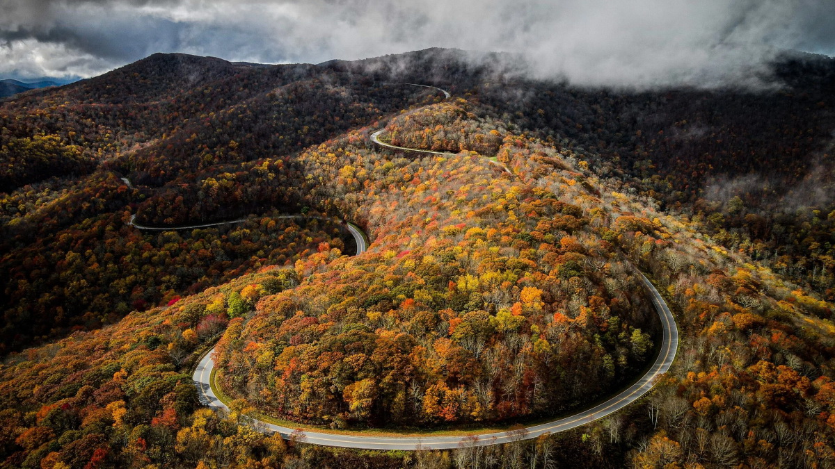
America's mountain ranges offer some of the most spectacular and challenging motorcycle roads on the planet. From the misty peaks of the Great Smokies to the towering passes of the Rocky Mountains, these routes deliver the perfect blend of breathtaking scenery, technical riding, and pure freedom. Whether you're a seasoned sport rider craving tight corners or a touring enthusiast seeking panoramic vistas, this guide covers the absolute best mountain motorcycle roads across the United States. Legendary routes such as the Tail of the Dragon, Beartooth Highway, Million Dollar Highway, and Blue Ridge Parkway are consistently ranked among the finest by experienced riders—and they all deserve a spot on every motorcyclist's bucket list.
Table of Contents
🌲 The Blue Ridge Parkway – Virginia & North Carolina
The Blue Ridge Parkway – Virginia & North Carolina
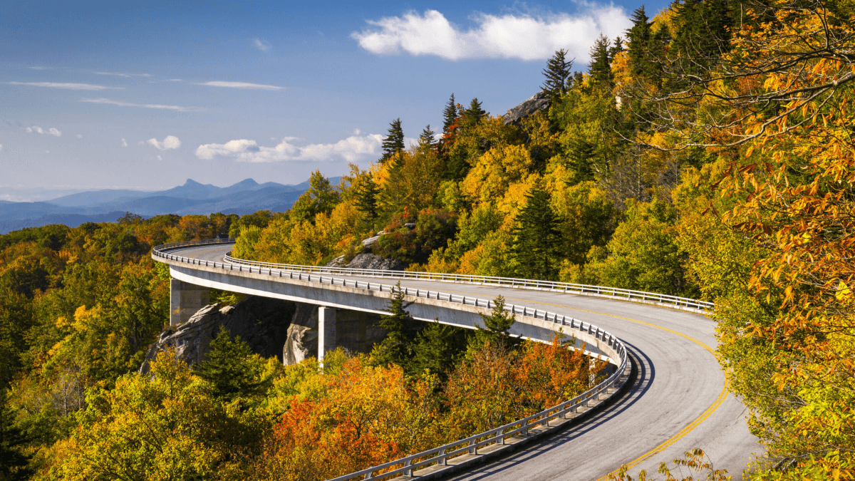
The Blue Ridge Parkway stands as the crown jewel of American motorcycle touring routes. Stretching 469 miles with no stop signs or traffic lights, this national park road offers motorcyclists a ride filled with sweeping curves, mountain vistas, and peaceful stretches of open road. The Parkway's design deliberately blends into the landscape, with shoulders that narrow in places so meadows and forest edges grow close to the pavement—creating an immersive riding experience unlike any other.
Why It's a Top Destination
What makes the Blue Ridge Parkway exceptional is its consistent quality and remarkable variety. The North Carolina sections, from Blowing Rock to Craggy Gardens, feature the famous Linn Cove Viaduct and provide access to Mount Mitchell—the highest peak east of the Mississippi at 6,684 feet. The Parkway's highest point, Richland Balsam Overlook at 6,047 feet, rewards riders with spectacular 360-degree mountain views that stretch for miles on clear days.
Safety Considerations
According to National Park Service data, the Parkway sees approximately 250 motorcycle accidents annually, with more than half resulting in serious injury. Key safety practices include riding in the center of your lane to avoid unforgiving road shoulders, watching for decreasing-radius curves that tighten unexpectedly, and maintaining single-file formation when riding in groups. Road hazards such as fallen rocks, tree debris, and loose gravel are common—particularly after rain. Riders should also remain vigilant for wildlife crossings, especially during early morning and evening hours when deer and elk are most active.
🔥 The Tail of the Dragon – Tennessee & North Carolina
The Tail of the Dragon – Tennessee & North Carolina
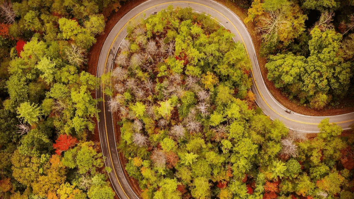
Known as "America's most exciting 11 miles," the Tail of the Dragon (U.S. Route 129) route attracts an estimated 250,000 riders annually. This legendary stretch features 318 curves—some as tight as 10 mph—bordering the Great Smoky Mountains National Park and Cherokee National Forest. With no houses, driveways, or intersecting roads to interrupt the rhythm, it offers a pure, uninterrupted riding experience.
What Makes It Special
The Dragon's relentless sequence of curves demands absolute concentration. Unlike most mountain roads, there is virtually no straight pavement to rest—every mile challenges both machine and rider. The road gained national prominence in the 1990s and has since become a global bucket-list destination. Riders can document their conquest at Deal's Gap Motorcycle Resort, where the famous "Dragon Tree of Shame" displays twisted metal and broken plastic from those who didn't tame the beast.
Important Tips
The Tail of the Dragon is not for sightseeing—keep your eyes on the pavement at all times. April through October offers the best riding conditions, while winter should be avoided entirely. Night riding is extremely dangerous due to the complete lack of street lighting and heightened wildlife activity. Always wear full protective gear, including a full-face helmet, armored jacket, and sturdy gloves.
🏔️ Cherohala Skyway – North Carolina & Tennessee
Cherohala Skyway – North Carolina & Tennessee
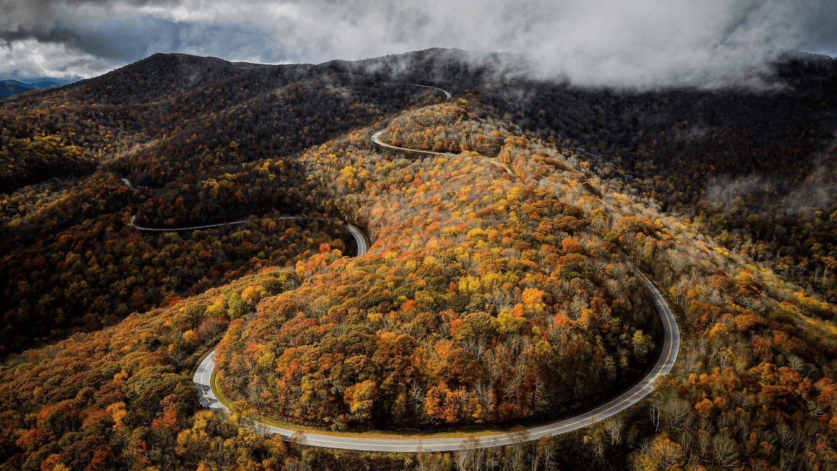
For riders seeking Blue Ridge Parkway-caliber scenery with significantly fewer crowds, this guide covers the absolute best scenic motorcycle roads across the United States. Cherohala Skyway delivers 43 spectacular miles connecting Robbinsville, North Carolina, to Tellico Plains, Tennessee. This National Scenic Byway took 34 years to complete and opened in 1996, linking Tennessee's Cherokee National Forest with North Carolina's Nantahala National Forest.
Riding Experience
The Skyway offers sweeping vistas from numerous well-placed overlooks, with the Santeetlah Scenic Pull-off at 5,400 feet providing particularly breathtaking panoramas. The road's generous curves and steady elevation changes reward smooth, rhythmic riding rather than aggressive cornering. Many local riders consider it superior to the Dragon for pure enjoyment—one experienced motorcyclist described it as "fifty miles per hour in a full lean for ten seconds, then another ten seconds in the opposite direction."
🏜️ The Million Dollar Highway – Colorado
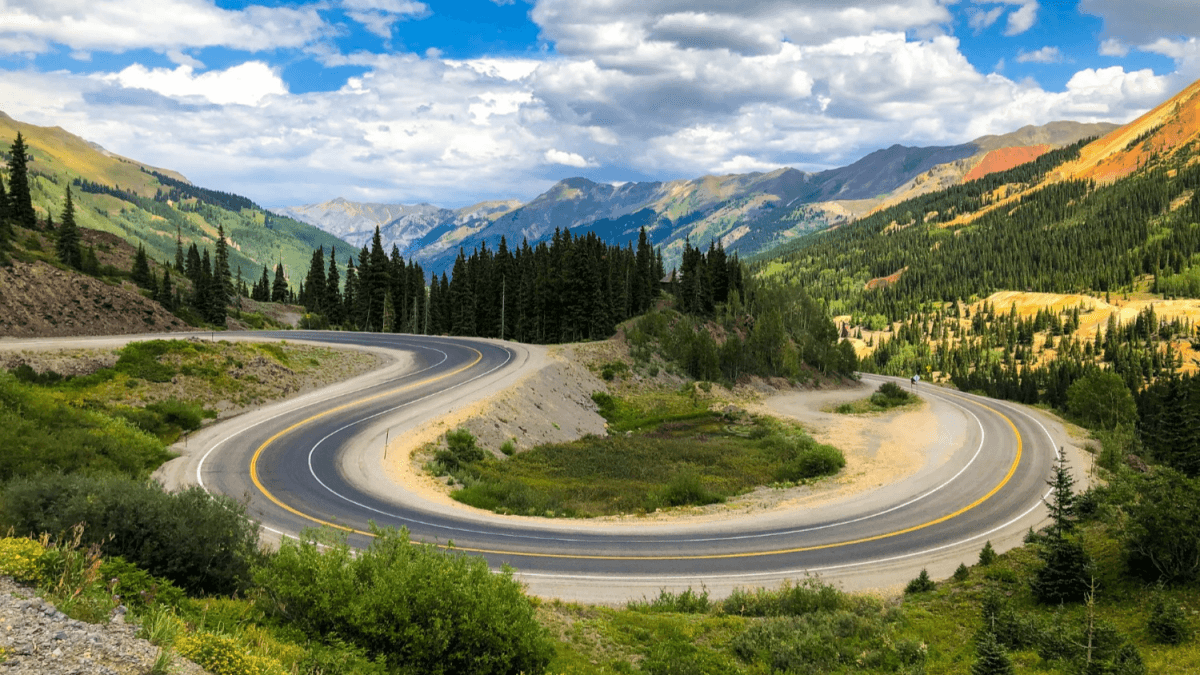
The Million Dollar Highway – Colorado
Colorado's Million Dollar Highway, part of U.S. Route 550 between Ouray and Silverton, cuts through the heart of the San Juan Mountains with exposed passes, minimal guardrails, and sheer drop-offs that demand total focus. The road earned its name either from the gold and silver ore used in its construction or, as many believe, from the million-dollar views it delivers at every turn.
Challenges and Rewards
This route features steep climbs, tight switchbacks, and the infamous "Red Mountain Pass" section where the road clings precariously to cliff faces. The absence of guardrails on certain stretches means a single mistake could be catastrophic, making this a route strictly for experienced riders comfortable with heights and technical terrain. The payoff, however, is some of the most dramatic mountain scenery in North America—old mining towns, alpine lakes, and jagged peaks around every corner.
🏔️ Beartooth Highway – Montana & Wyoming
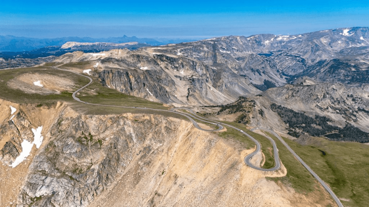
Beartooth Highway – Montana & Wyoming
Montana's Beartooth Highway climbs to nearly 11,000 feet, threading switchbacks and alpine plateaus between Red Lodge and Cooke City. With dramatic elevation changes, sharp hairpins, and limited guardrails, this road offers one of the most thrilling and visually stunning rides in the country.
Route Details
The 64-mile route begins in Red Lodge, heading south on US-212 through progressively more impressive terrain. The tightest series of switchbacks approaches the summit, with Vista Point Observation providing an essential stop. The route crosses into Wyoming through Shoshone National Forest and the Beartooth Basin before returning to Montana and ending in Cooke City—the northeast gateway to Yellowstone National Park. This seasonal road typically opens only from late May through October, and snow can close the pass even in June.
❄️ Going-to-the-Sun Road – Montana
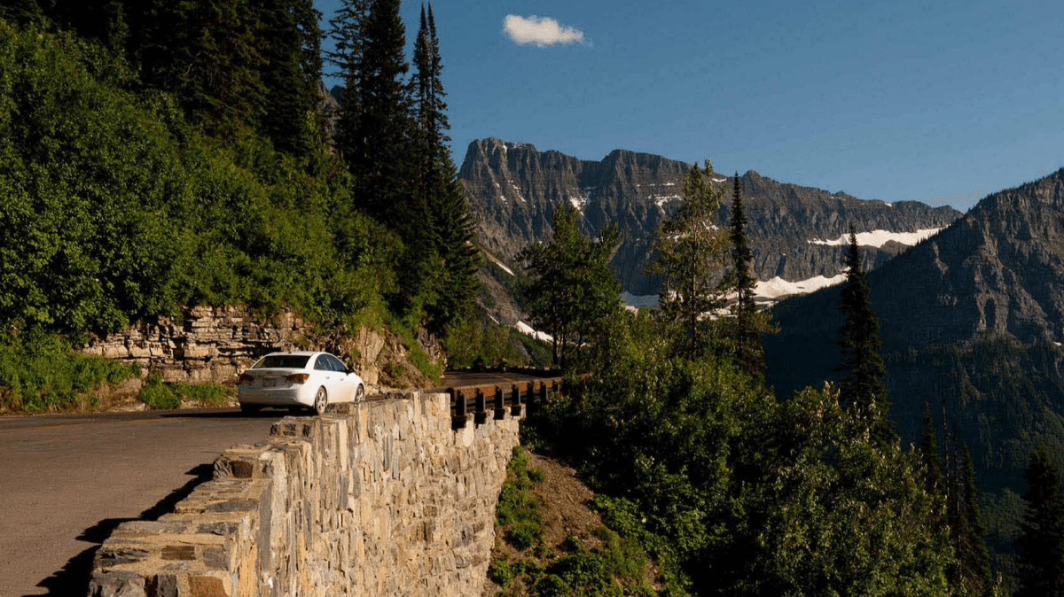
Going-to-the-Sun Road – Montana
Often compared to Mount Everest for its engineering difficulty and remote beauty, Glacier National Park's Going-to-the-Sun Road is a 50-mile marvel carved through some of the most rugged terrain in the lower 48. The road traverses the Continental Divide at Logan Pass (6,646 feet), offering views of rugged peaks, glacial lakes, and alpine terrain that rival any mountain road on Earth.
Riding Strategy
Starting from West Glacier, riders cross the Middle Fork Flathead River and follow the shores of Lake McDonald before beginning the ascent. Once the road pulls away from the river valley, the ride becomes increasingly dramatic—with minimal guardrails and mostly stone walls protecting riders from sheer drops of hundreds of feet. Logan Pass offers a popular stopping point to rest and take in the surrounding majesty. Like Beartooth Highway, this road is only open during summer months, and weather can shift rapidly above the treeline.
🌄 Great Smoky Mountains Network – Tennessee & North Carolina
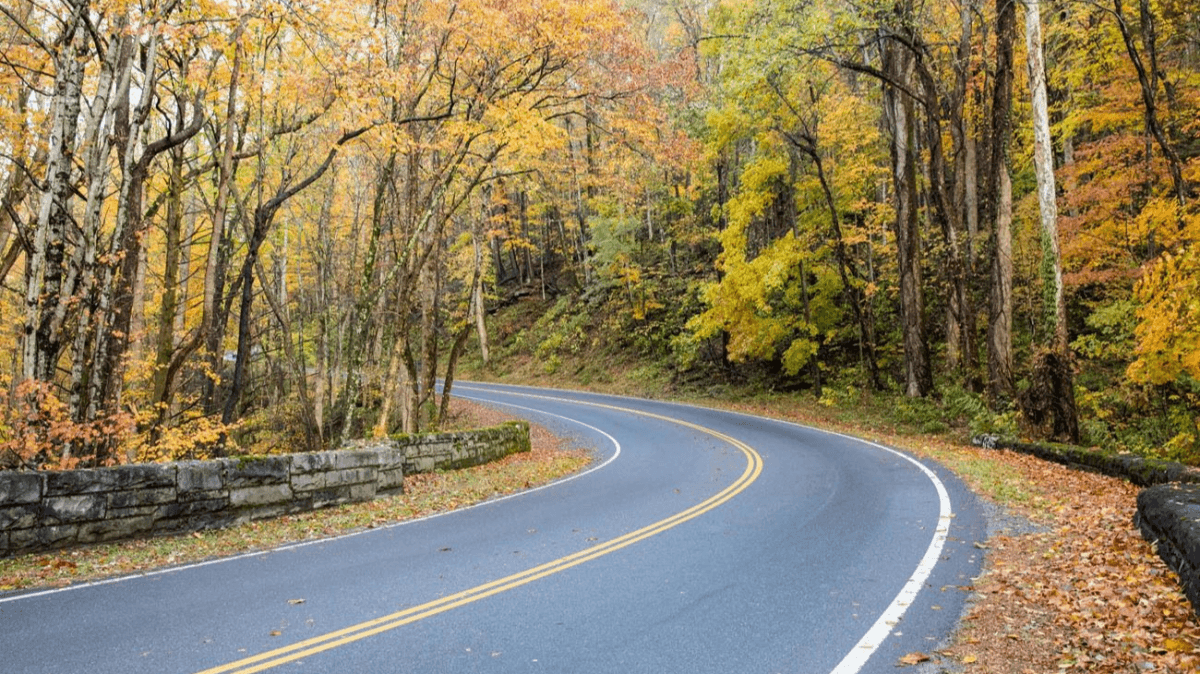
Great Smoky Mountains Network – Tennessee & North Carolina
The Smokies don't present themselves as a single ride but as a diverse network of interconnected mountain roads forming one of the most versatile motorcycle travel regions in the eastern United States.
Key Routes
- Newfound Gap Road (U.S. 441):The high-mountain artery connecting Gatlinburg to Cherokee, climbing from river valleys to nearly 6,000 feet with panoramic views at the state line
- Cades Cove Loop Road:An 11-mile, one-way loop through a preserved valley featuring historic cabins, open meadows, and frequent wildlife sightings—including black bears and white-tailed deer
- Little River Road:Flowing sweepers along a scenic river valley connecting Townsend to the Foothills Parkway
- Foothills Parkway:A 33-mile scenic route offering panoramic overlooks with gentle curves ideal for relaxed cruising
Seasonal Considerations
The Smokies are rideable year-round at lower elevations, but prime season runs from late spring through mid-fall. Spring offers lighter traffic and fresh mountain greenery; summer delivers long riding days but frequent afternoon thunderstorms; fall provides spectacular foliage but heavy congestion. Winter can bring ice and closures at higher elevations. Cell service is inconsistent throughout the park, making communication gear a practical necessity.
🏞️ The Rattler (NC 209) – North Carolina
Running from near Waynesville to Hot Springs, The Rattler offers 33 miles of rural mountain riding through tiny communities with names like Luck, Trust, and Bluff—some locals affectionately call it "The Gambler." The route ends in Hot Springs, where the natural hot tubs at Hot Springs Resort provide a perfect post-ride soak. The 66-mile round trip (or 90-mile loop via NC 25 and 63) delivers classic Appalachian riding without the crowds of more famous routes.
🌀 The Diamondback (NC 226A) – North Carolina
The Diamondback forms a diamond-shaped loop of twisting back roads around Little Switzerland, a favorite summer destination with dramatic views overlooking the Blue Ridge Parkway. Starting near Marion, riders can incorporate the Parkway at the top for a 10-mile add-on featuring views of Mount Mitchell. The nearby NC 80—known to some as "The Devil's Whip"—offers an alternate descent for advanced riders seeking even more technical challenge.
🏍️ Essential Gear for Mountain Riding
Now that you know where to ride, let's discuss how to prepare. Mountain riding demands more than a reliable bike—it requires thoughtful gear selection to handle rapid weather shifts, remote stretches, and unpredictable road surfaces.
A quality Helmet Communication system keeps you connected to riding partners, allowing real-time warnings about hazards, traffic, or simply sharing the excitement of a spectacular overlook. Similarly, a reliable Bluetooth Intercom ensures clear communication even in areas without cell service—which is common across most national forests and mountain passes. For group rides, a Motorcycle Intercom system enhances safety by enabling seamless coordination through technical sections.
Other essentials include:
- Layered riding gear(base layer, insulating mid-layer, waterproof shell) for temperature swings of 20–30°F with elevation gain
- Tire pressure monitor and portable repair kit—punctures are common on debris-strewn mountain passes
- Full-face helmet with anti-fog visor—fogging is a major hazard in cold, damp mountain air
- Heated grips or heated glovesfor high-altitude sections, even in summer months
- Offline GPS or paper maps—cell coverage is unreliable in most national forests
- Hydration pack and high-energy snacks—services can be 50+ miles apart
- Emergency blanket and first-aid kitfor unexpected overnight stays due to weather or breakdowns
📋 Planning Your Best Mountain Motorcycle Road Trip – Quick Reference
Best Time to Visit by Region
| Season | Southern Routes (Smokies, BRP) | Northern Routes (Rockies, MT) |
| Spring | Good—light traffic, wildflowers | Limited—high passes still snowbound |
| Summer | Good—long days, afternoon storms | Best—fully open, ideal conditions |
| Fall | Best—foliage, but heavy crowds | Good—crisp air, fewer tourists |
| Winter | Limited—lower elevations only | Closed—most passes inaccessible |
Skill Level Requirements
| Level | Recommended Routes |
| Beginner/Intermediate | Blue Ridge Parkway, Foothills Parkway, Cherohala Skyway |
| Intermediate/Advanced | Tail of the Dragon, The Rattler, The Diamondback |
| Advanced | Million Dollar Highway, Beartooth Highway, Going-to-the-Sun Road |
Safety Priorities
- Check weather forecasts daily and plan for rapid changes at elevation
- Carry layered gear for temperature variations of 20+ degrees
- Inspect tires, brakes, and lights before every ride
- Use Helmet Communicationor Bluetooth Intercom for group riding safety
- Watch for wildlife—especially at dawn, dusk, and in early summer
- Respect guardrails—or the lack thereof
- Never pass up fuel—stations are sparse in remote mountain areas
❓ Frequently Asked Questions
What is the best mountain motorcycle road in America for beginners?
The Blue Ridge Parkway and Cherohala Skyway are the top choices for less experienced riders. Both offer smooth pavement, predictable curves, and forgiving shoulders. The Parkway provides 469 miles of relaxed touring with ample overlooks for breaks, while the Skyway features gentle sweepers and steady elevation changes without extreme switchbacks.
Is the Tail of the Dragon dangerous?
Yes—it is considered one of the most challenging motorcycle roads in America. Its 318 curves in 11 miles demand constant focus, and conditions can change quickly due to weather or debris. However, with proper preparation—riding within your limits, avoiding target fixation, using appropriate gear, and maintaining safe following distances—it can be a thrilling but manageable experience.
When is the best month to ride mountain roads in the US?
June through September is optimal for northern routes like Beartooth Highway and Going-to-the-Sun Road, when high passes are fully open and snow-free. For southern routes like the Blue Ridge Parkway and Smokies, May through October offers excellent conditions, with September–October delivering fall colors (though heavier traffic).
What safety gear is essential?
At minimum: a DOT-approved full-face helmet, armored jacket and pants, gloves, over-ankle boots, layered clothing for temperature swings, and a reliable Helmet Communication system or Bluetooth Intercom to stay in touch with riding partners in areas without cell coverage.
Do I need cell service or communication devices?
Most mountain routes have poor or no cell service for significant stretches. A Bluetooth Intercom or Motorcycle Intercom is highly recommended for group rides—enabling real-time hazard alerts, pace coordination, and emergency communication without cellular networks.
Are there gas stations along these routes?
Fuel availability varies. The Blue Ridge Parkway has limited fuel directly on it; the Tail of the Dragon has fuel at Deal's Gap; the Cherohala Skyway has none on the route. Always top off when you see a station—distances between fuel stops can exceed 80 miles in remote areas.
Can I ride these roads with a passenger or loaded touring bike?
Yes, but with extra caution on tight routes like the Tail of the Dragon and Million Dollar Highway. Reduce speed, use engine braking, and increase following distance. A Motorcycle Intercom is especially useful for rider-passenger communication on demanding sections.
What should I do if I encounter sudden bad weather?
- Slow down immediately and avoid sudden braking or sharp turns
- Pull over at a safe overlook if visibility drops below safe levels
- Wait out the storm—most summer afternoon showers pass within 30–60 minutes
- Avoid standing water, which can hide potholes or cause hydroplaning
- If lightning is frequent, seek lower elevation or shelter
Are there tolls or entry fees?
Most are free. The Blue Ridge Parkway, Tail of the Dragon, Cherohala Skyway, and Beartooth Highway have no tolls. Going-to-the-Sun Road requires a Glacier National Park entry fee. Great Smoky Mountains roads are free.
How many days should I plan?
- Single route focus (e.g., Tail of the Dragon + Cherohala Skyway): 2–3 days
- Blue Ridge Parkway end-to-end: 5–7 days
- Colorado or Montana multi-pass loop: 7–10 days
- Always add 1–2 buffer days for weather or unexpected delays
📋 Final Pre-Ride Checklist
- □ Weather forecast checked for all elevations along your route
- □ Tires, brakes, fluids, and lights inspected
- □ Helmet Communicationor Bluetooth Intercom fully charged and paired
- □ Motorcycle Intercomtested for group clarity
- □ Offline maps downloaded or GPS updated
- □ Layered gear packed for temperature swings
- □ Fuel stops planned—know where your next gas station is
- □ Emergency contact and roadside assistance info saved
- □ Camera or action cam ready for those million-dollar views
Whether you're chasing the 318 curves of the Dragon, the alpine majesty of Beartooth Pass, or the endless sweepers of the Blue Ridge Parkway, America's mountain roads deliver experiences unmatched anywhere in the world. Pack your gear and get ready for the ride of a lifetime. Ride safe, ride smart, and savor every mile.

Rodney L is a technical writer and product consultant with over a decade of experience in the motor industry. Rodney is a fan of performance machines that run fast and loud and an expert in all things custom. His numerous articles and write-ups are available at our knowledge base. Whether it’s something wrong with your motorcycle or you are building a custom bike, you can trust Rodney’s experience.
You maybe like to read:
Fodsports Brand Month: Unbeatable Deals and Top-Notch Service
Discover Fodsports Brand Month July and August mark a special occasion for motorcycle enthusiasts and tech lovers alike. Welcome to Fodsports Brand Month! This event is dedicated to celebrating everything that makes Fodsports a leading name in the motorcycle communication industry. Get ready for a fantastic promotions, exceptional service from Fodsports. Let's insights into Fodsports' […]
Cherohala Skyway Tennessee and North Carolina: Fall Motorcycle Riding Guide
Few motorcycle roads in the Southeast combine elevation, open mountain views, and flowing curves quite like the Cherohala Skyway. Stretching about 43 miles between Tellico Plains, Tennessee, and Robbinsville, North Carolina, the National Scenic Byway climbs from lower valleys to elevations above 5,000 feet before crossing the Appalachian high country. In fall, the ride becomes […]
10 Best Autumn Motorcycle Routes in Europe: Scenic Roads, Fall Colors and Riding Tips
🍂 Why Autumn Is One of the Best Seasons for a European Motorcycle Road Trip Europe becomes a completely different riding destination in autumn. Alpine forests turn gold, mountain valleys develop deeper colors, vineyards become vibrant, and many popular roads become quieter after the summer peak. For motorcycle travelers, the biggest advantage is variety. In […]
Pig Trail Scenic Byway Arkansas in Fall: Motorcycle Riding Guide
Winding through the Boston Mountains, the Pig Trail Scenic Byway is one of Arkansas's most enjoyable fall motorcycle routes. AR-23 combines tight mountain curves, dense hardwood forests, and the Mulberry River, creating a ride where the road itself is part of the scenery. In autumn, the Ozarks become even more impressive as the forest changes from […]
Tunnel of Trees Michigan in Fall: Motorcycle Riding Guide
Red and gold forests, winding roads, and glimpses of Lake Michigan make the Tunnel of Trees in Michigan a memorable fall motorcycle destination. The roughly 20-mile M-119 route between Harbor Springs and Cross Village is best enjoyed at a relaxed pace, with plenty of time for scenic stops. Planning a ride in 2026 requires extra attention, […]