The motorcycle communication systems field just got a significant upgrade with the release of the Fodsports FX7. This state-of-the-art Bluetooth mesh intercom is packed with many advanced features and techs. It will revolutionize the way riders communicate and enjoy their rides. Whether you're a solo rider or part of a group, the FX7 offers unparalleled […]

Talimena Scenic Byway in Fall: Oklahoma and Arkansas Motorcycle Riding Guide
October 6, 2026
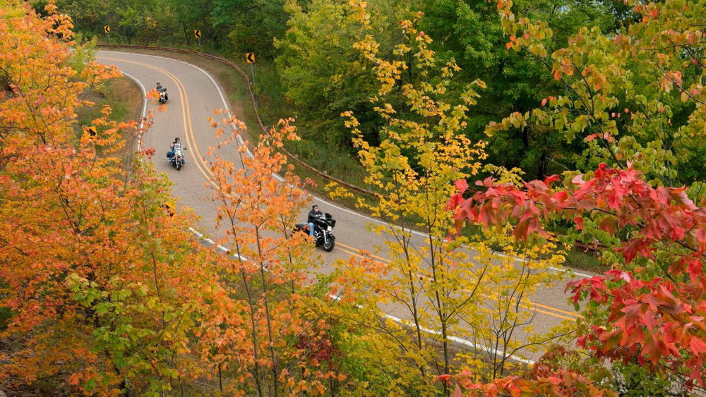
A mountain road, two states, 54 miles of ridgelines, and some of the best late-season color in the South—Talimena Scenic Byway is the kind of motorcycle route that rewards riders who leave room for the scenery.
Running from the Mena, Arkansas area to Talihina, Oklahoma, the byway follows the crests of the Ouachita Mountains through forest, overlooks, and changing fall color. The route takes about one to two hours to drive without stops, but riders who want to enjoy the overlooks should allow much longer.
For a fall motorcycle trip, Talimena is especially appealing because the riding season extends later into the year than many northern foliage destinations. Here is how to plan the route, when to go, where to stop, and what makes this Oklahoma-Arkansas ride worth the trip.
Table of Contents
🍂 Why Ride Talimena Scenic Byway in Fall?
The biggest attraction is the combination of mountain riding and long-distance views.
Unlike a road that stays deep inside a forest, Talimena follows the ridges of Winding Stair and Rich Mountains. The trees open frequently at designated overlooks, giving riders views across the Ouachita Mountains.
The route includes 22 designated vistas, making it easy to build natural breaks into a motorcycle ride instead of treating the 54 miles as a simple point-to-point journey.
Fall adds another layer. Oaks, maples, and other hardwoods turn the surrounding ridges into shades of red, orange, and gold.
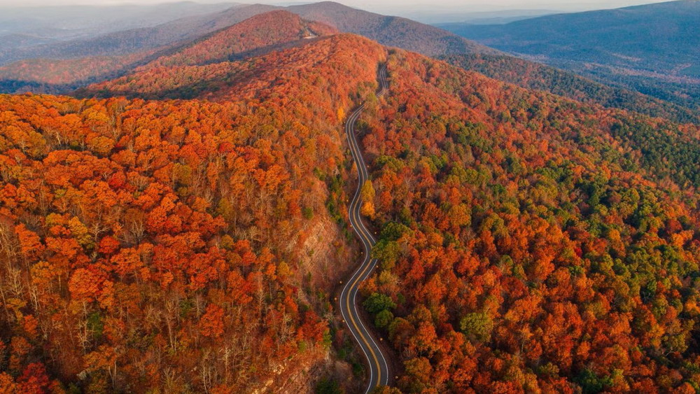
Talimena Scenic Byway Fall Road
📅 When Is the Best Time for Talimena Fall Foliage?
Talimena is one of the better choices for a late-season fall motorcycle ride.
Late October to Early November
Oklahoma's official tourism site generally identifies the last week of October through the first week of November as the typical peak foliage period along Talimena. Exact timing changes with weather, temperature, and elevation.
Higher elevations can change before some lower areas, so don't treat one specific weekend as guaranteed peak color.
For riders, a weekday trip can also make the experience more relaxed because peak foliage weekends attract visitors from both states.
🏍️ The Best Way to Ride the 54-Mile Route
The full route connects Mena, Arkansas, and Talihina, Oklahoma.
Start in Mena, Arkansas
Mena is the eastern gateway. The Arkansas section follows AR-88 for approximately 18 miles before reaching the Oklahoma state line.
This side quickly climbs toward Rich Mountain and Queen Wilhelmina State Park, making it a strong choice if you want mountain scenery early in the ride.
Ride Through Rich Mountain
Rich Mountain reaches 2,681 feet, making it Arkansas' second-highest peak. Queen Wilhelmina State Park sits on the mountain and provides one of the route's most useful stopping points.
The higher elevation also helps explain why the route can feel noticeably different from the towns below.
Continue Toward Talihina
After crossing into Oklahoma, OK-1 continues along the Ouachita ridges toward the Talihina area.
This section contains many of the route's panoramic viewpoints, including Choctaw Vista, Potato Hills Vista, Panorama Vista, and Emerald Vista.
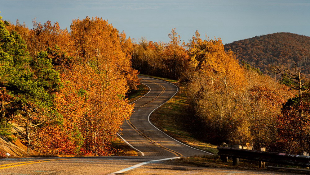
Talimena Scenic Byway Ouachita Mountains Fall
📍 Best Stops Along the Ride
You do not need to stop at every overlook. A few well-chosen breaks can make the ride more enjoyable.
Queen Wilhelmina State Park
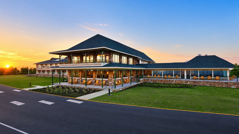
Queen Wilhelmina State Park
This is one of the best places to pause on the Arkansas side. The park sits atop Rich Mountain and offers panoramic views, lodging, dining, trails, and other facilities.
Panorama Vista
Panorama Vista is a good example of what makes Talimena different from ordinary forest roads: the view opens across the surrounding mountain landscape rather than simply showing another section of trees.
Talimena State Park
Near the Oklahoma gateway, Talimena State Park provides another useful stop before or after the main mountain section. It also offers camping and outdoor recreation.
State Line Historical Monument
The Arkansas-Oklahoma border is more than a navigation point. The route includes historical markers that add some cultural context to the landscape. The Forest Service identifies the Choctaw Nation/State Line Historical Monument among the byway's attractions.
🛣️ What Makes Talimena Good for Motorcycles?
Talimena is not a racetrack. Its appeal comes from the combination of sweeping curves, elevation changes, ridge-top scenery, and frequent opportunities to stop.
The best riding strategy is to maintain a pace that leaves enough attention for changing road conditions and vehicles.
Wildlife is also present throughout the Ouachita National Forest. Official byway information notes the possibility of seeing animals such as black bears and roadrunners.
That means riders should scan beyond the pavement, particularly near wooded sections and during lower-light periods.
⛽ Fuel and Route Planning
One of the most useful planning details is simple: fuel before committing to the byway.
The main route is rural, and there are no continuous fuel or service options along the ridgeline. Mena and the Talihina area are the logical places to handle fuel and other essentials before starting the scenic section.
Also, download your route before entering the mountains. Cell service can vary, and a scenic road is not the place to stop in an unsafe location just to solve a navigation problem.
For a first visit, allow at least half a day if you want to stop at several vistas. The official America's Byways guide suggests about five hours to fully enjoy the route rather than simply drive through it.
📡 Group Riding and Motorcycle Communication
Talimena's long stretches of scenic riding make it a good route for small motorcycle groups.
A Helmet Communication system can help riders communicate upcoming stops or road hazards without repeatedly pulling over.
A Bluetooth Intercom is also useful when traffic or different riding speeds separate the group.
For larger groups, a Motorcycle Intercom can make regrouping easier, especially when riders want to keep communication short and focused.
The goal is simple: communicate when it improves the ride, not when it distracts from it.
📊 Talimena Scenic Byway by the Numbers
A few statistics put the route into perspective:
- 54 miles: total length of the National Scenic Byway.
- 18 miles: approximate Arkansas portion between Mena and the Oklahoma state line.
- 22 vistas: designated scenic viewpoints along the route.
- 2,681 feet: elevation of Rich Mountain, Arkansas' second-highest peak.
- Nearly 1.8 million acres: size of the Ouachita National Forest across Arkansas and Oklahoma.
- 6,228 motorcyclists: killed in U.S. traffic crashes in 2024, accounting for 16% of all traffic fatalities, according to NHTSA.
The final number is a useful reminder that even a scenic motorcycle trip deserves the same attention to speed, visibility, and road awareness as any other ride.
🌄 One-Day or Weekend Motorcycle Trip?
One-Day Ride
A one-day trip works well if you mainly want to ride the 54-mile byway and visit several major overlooks.
Start early, fuel up in Mena or near Talihina, and allow enough daylight for stops.
Weekend Trip
A weekend gives you more flexibility.
Stay around Mena or Talihina, ride the byway without rushing, and add nearby Ouachita roads, hiking areas, or state parks to the itinerary.
This is especially useful during peak foliage because you can avoid trying to see every viewpoint in a single push.
🍁 Final Thoughts
The Talimena Scenic Byway stands out because it combines the things motorcycle riders usually look for in a scenic route: curves, elevation, open views, forest roads, and enough stopping points to turn the ride into a full experience.
Fall makes the 54-mile route even more memorable, particularly from late October into early November when the Ouachita Mountains can fill with red, orange, and gold.
The best strategy is not to rush from Mena to Talihina. Fuel up first, choose a few overlooks, watch for wildlife, and leave enough time to enjoy the mountain views.
For riders looking for an Oklahoma and Arkansas fall motorcycle route, Talimena is more than a scenic drive. The road itself is the destination.
❓ FAQ About Talimena Scenic Byway
1. How long is the Talimena Scenic Byway?
The Talimena Scenic Byway is approximately 54 miles long, connecting the Mena, Arkansas area with Talihina, Oklahoma.
2. When is the best time to ride Talimena Scenic Byway in fall?
Late October through early November is generally the most popular foliage window. Exact peak color varies each year depending on weather and elevation.
3. Is Talimena Scenic Byway good for motorcycles?
Yes. The route combines winding mountain roads, elevation changes, scenic overlooks, and relatively long stretches of uninterrupted riding. It is best enjoyed at a controlled pace rather than treated as a speed-focused road.
4. Where should I start the Talimena Scenic Byway?
You can ride from either direction. Mena, Arkansas, is the eastern gateway, while the Oklahoma entrance is near the junction of OK-1 and US-271 northeast of Talihina.
5. How much time should I allow for the Talimena Scenic Byway?
Although the route can be driven in roughly one to two hours without extended stops, five hours is a better target if you want to visit overlooks and enjoy the scenery.
📚 Authoritative Sources
- Federal Highway Administration — America's Byways: Talimena Scenic Drive
- USDA Forest Service — Ouachita National Forest / Talimena Scenic Drive
- TravelOK — Oklahoma's Official Talimena Scenic Byway Guide
- com — Talimena Scenic Byway
- NHTSA — Motorcycle Safety

Rodney L is a technical writer and product consultant with over a decade of experience in the motor industry. Rodney is a fan of performance machines that run fast and loud and an expert in all things custom. His numerous articles and write-ups are available at our knowledge base. Whether it’s something wrong with your motorcycle or you are building a custom bike, you can trust Rodney’s experience.
You maybe like to read:
Fodsports Brand Month: Unbeatable Deals and Top-Notch Service
Discover Fodsports Brand Month July and August mark a special occasion for motorcycle enthusiasts and tech lovers alike. Welcome to Fodsports Brand Month! This event is dedicated to celebrating everything that makes Fodsports a leading name in the motorcycle communication industry. Get ready for a fantastic promotions, exceptional service from Fodsports. Let's insights into Fodsports' […]
Talimena Scenic Byway in Fall: Oklahoma and Arkansas Motorcycle Riding Guide
A mountain road, two states, 54 miles of ridgelines, and some of the best late-season color in the South—Talimena Scenic Byway is the kind of motorcycle route that rewards riders who leave room for the scenery. Running from the Mena, Arkansas area to Talihina, Oklahoma, the byway follows the crests of the Ouachita Mountains through forest, […]
Cherohala Skyway Tennessee and North Carolina: Fall Motorcycle Riding Guide
Few motorcycle roads in the Southeast combine elevation, open mountain views, and flowing curves quite like the Cherohala Skyway. Stretching about 43 miles between Tellico Plains, Tennessee, and Robbinsville, North Carolina, the National Scenic Byway climbs from lower valleys to elevations above 5,000 feet before crossing the Appalachian high country. In fall, the ride becomes […]
10 Best Autumn Motorcycle Routes in Europe: Scenic Roads, Fall Colors and Riding Tips
🍂 Why Autumn Is One of the Best Seasons for a European Motorcycle Road Trip Europe becomes a completely different riding destination in autumn. Alpine forests turn gold, mountain valleys develop deeper colors, vineyards become vibrant, and many popular roads become quieter after the summer peak. For motorcycle travelers, the biggest advantage is variety. In […]
Pig Trail Scenic Byway Arkansas in Fall: Motorcycle Riding Guide
Winding through the Boston Mountains, the Pig Trail Scenic Byway is one of Arkansas's most enjoyable fall motorcycle routes. AR-23 combines tight mountain curves, dense hardwood forests, and the Mulberry River, creating a ride where the road itself is part of the scenery. In autumn, the Ozarks become even more impressive as the forest changes from […]